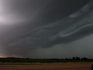
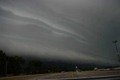
Storms started in S.Wisconsin and eventually developed SE into N.IL . Strong damaging winds occurred with the line and produced a great looking shelf cloud. I got a few shots in Rock county near Janesville and then then the Shelf cloud storm near Beloit WI. I headed south and got into the storm in Machesney Park IL in Winnebago co. The storm did cause some power outages and high damaging winds. Radar images added below.
ON THE GUST FRONT
Chase photos and accounts- Past events/Photos
Thursday, December 27, 2012
6-29-12 Lee County IL
A line of storms moved east through the area and displayed a nice looking ominous shelf cloud. Winds gusted over 60mph. At the time I did not have my wide angle lens which would have been perfect for this storm. Farther north toward Rockford it produced some decent Mammatus clouds.
.
.
5-28-12 Prophetstown IL
This storm was very strong/severe as it moved across the MS river into NW IL. As it moved into eastern Whiteside co. near Prophetstown the storm weakened considerably. It gusted out and produced a Haboob or a small dust storm. Winds gusted to 60 mph for a time. Donovan Gruner a fellow chaser and friend of mine were on this storm. Storms also produced a nice looking Sunset on the way back in Ogle county too.
Wednesday, May 16, 2012
May's Dancing Rain Curtains and Rainbows- May-14th 2012
Can't really call this a chase but caught a rather photogenic cell moving SE into North Winnebago county just north of RFD. Had some nice rain curtains and lightning was mostly intra-cloud or Cloud to cloud. Has some nice rainbows afterwards. Not bad for a marginal day at best.
Still waiting for the main show this year..
Still waiting for the main show this year..
May 6th Supercell in NW -NC IL
Finally got out and chase this year and ended up in NW and NC IL.. Was heading south down I-39 and cells were exploding in Lasalle Co. area. They seemed to heading East initially and would have been perfect for intercept but they moved more and more ESE and SE.. so had to take a more SW turn to intercept.. I never did get into perfect position but got in the center of one near Henry IL. This cell indicated huge hail. I think the largest was just down the way from me but I got 1" hail at most.. Golf ball was reported nearby. The cell got Tornado warned but never produced. Got a few shots though of the cell. Great seeing so many other chasers nearby and on SN...next !
Sunday, August 21, 2011
Last updated 08/21/11
The Month of July will be remembered in N.IL for repeated rounds of storms and mainly wind damage.
The following are accounts of these events.
The heat was also intense for here as we hit 100 2x with a record level of Humidity..but nothing like the S.plains.
Earlier year Photo Galleries on Page 2 ! Click on pics for larger or animation.
Severe Storm N. Winnebago co 8/20/11
Some thunderstorms formed in S.WI and grazed the north part of Winnebago county. Hail was reported to quarter size especially around Beloit WI. Here it produced an impressive shelf cloud..this in NE Rockford.
Subscribe to:
Comments (Atom)


